The GWRC GIS Open Data Site - BETA
Author: John Gibson
The GWRC GIS Open Data Site is an interactive application built to allow sharing of our GIS data with the community.
Greater Wellington Regional Council holds many thousands of individual digital data sets covering the region. The datasets have come from the council's activities as well as those of partner agencies, Crown Research Institutes and predecessor agencies of the council such as Catchment Boards and Harbour Boards.
A subset of some of the more popular data has been prepared for download and documented with relevant descriptions (metadata).
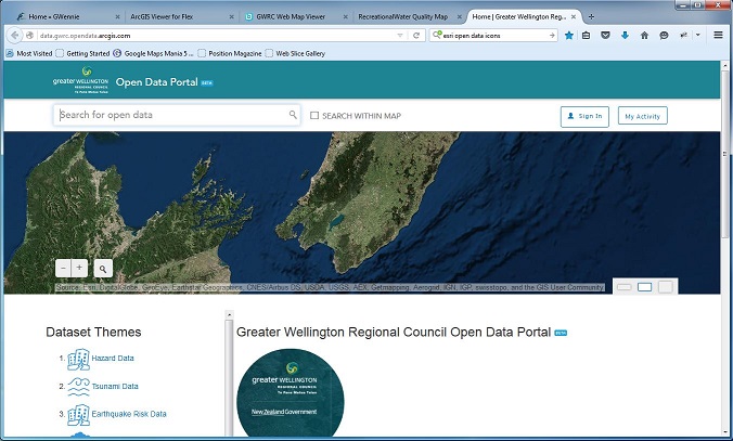
Below is an image of the site as it currently exists (it is a test release in "Beta" test).
Follow the step-by-step instructions below to view and download desired data.
- Find your location of interest by using the pan/zoom tools.
- Use the Search panel to search on a term of interest, or click on a Theme name to list the relevant records.
- Click on a theme name to view details and see the layer in the map window.
- A download button is provided to allow download of all or part of the dataset.
We welcome your feedback – the application is in BETA so now is a great chance for you to get involved! Let us know what datasets you are interested in seeing in the Open Data Site; how easy you have found it to use; any comments you would like to make to help us make it a valuable tool for you.
Published: 20/06/2016