New detailed streams datasets released
Author: Gareth Palmer
With the increasing use of GIS data, the need for higher quality spatial data has been recognised. This is driven by science, engineering and policy needs which require precise location data on features. Recent GWRC scientific collaborations have shown the need for more accurate river and stream course data, e.g. for stream vegetation analysis. In response, GWRC has analysed a Digital Terrain Model (DTM) generated from Laser Airborne (LiDAR) data collected in the summer of 2013/2014 to produce accurate streamlines in two of the major catchments ( whaitua) in the region.
These catchments are the Ruamahanga (Western Wairarapa) and Porirua whaitua. This data is now freely available for download here. These stream datasets match streams seen in contemporary high-resolution aerial photos.
Other existing options for river and stream centreline datasets are the Topo50 series data provided by LINZ or the River Environment Classification (REC) produced by NIWA.
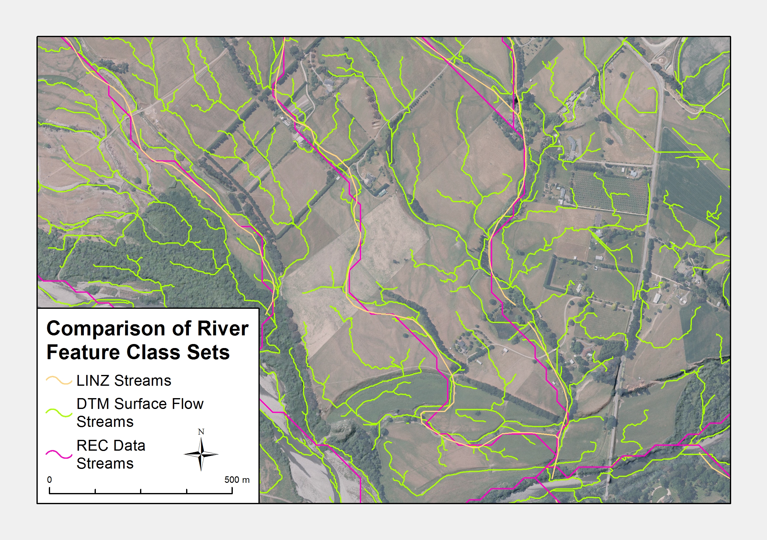
- The LINZ datasets, in particular the river centrelines, are designed to be viewed at 1:50,000 scale and while it is able to be viewed below that scale it will generally begin to be inappropriate when the map reaches 1:10,000 and lower. The data produced from the surface modelling is able to match stream courses at 1:50 scales and models a significantly larger number of stream courses than the LINZ data.
- The REC data provides detailed attribution to the streams that it has modelled, able to show information such as stream gradient, base geology and climate. Note that the REC data is able to be linked to the high detailed streams through the Reach IDs but the new GWRC datasets are possibly too precise to show the REC information reliably.
Below is an example image of the streams mapping; the new GWRC stream lines are shown as DTM Surface Flow Streams.
Note that the streamline data is derived by semi-automated modelling of overland flow from the DTM, and is not always capable of defining where existing streams have been piped or culverted. The Wairarapa Eastern Hills is the third major area is currently being processed for streamlines and is due to be completed in late 2016
Published: 02/08/2016 Updated 27/02/2017